Geography:
Subject Information Overview
Below is a visual overview of the content available on this page. Click the appropriate title to view the relevant section
Curriculum
Area Staff Curriculum
InformationCurriculum
OverviewExam information for GCSE
qualifications in this Subject AreaKnowledge
Organisers
Curriculum Area Staff
|
Colum McArdle (HoF/CAL Geography) Charlotte Hall |
Stephen Hawksworth (House Leader) |
Should you require more information about this subject area please contact:
Name: Mr Colum MrArdle
Position: Curriculum Area Leader
Email: cmc@selbyhigh.co.uk
Curriculum Information
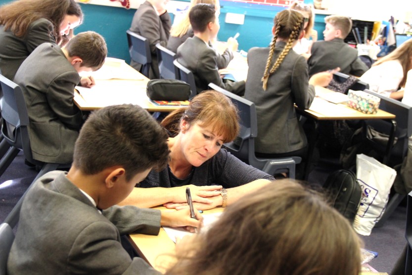
We aim to provide students with high quality geographical information through stimulating and exciting lessons using a wide range of teaching styles and techniques. Geography is more than memorising the location of places on a map and our Geography curriculum will allow pupils to reach their full potential and develop a sense of place, help them make sense of their surroundings and to better appreciate and understand the complexity of the physical and human conditions that exist on Earth.
Our geographers will study a demanding curriculum which will develop transferable skills to support inclusivity and progression. There will be a breadth of content, from the familiar to the unfamiliar, ranging from Selby to Britain to other parts of the world, using current examples to contextualise and engage learning. Our geographers will embrace the diversity our world has to offer and leave confident in understanding their place in the world.
In year 7, students will learn about the ‘Geography of the UK’. Students will study both human and physical components such as poverty, energy and water supply, waste management, weather and climate, climate change and population change at both the local and national level.
Throughout year 8 and year 9 students will build on this knowledge but with a focus on the ‘wider world’, specifically the human and physical characteristics of Africa, Asia and the Middle East. Students will study a broad range of topics including natural hazards, challenging landscapes, energy supply, population change and rivers and coasts. Key skills such as map and atlas skills will be studied across a range of topics.
Our curriculum is designed to create confident geographers. Selby High School Geography students should have a clear understanding of the world we live in both locally and globally. We aim to inspire and foster an enquiring mind in our students and develop students as geographical locators, writers, investigators and decision makers.
Curriculum Overview
| Year Group | Term 1 | Term 2 | Term 3 | Term 4 | Term 5 | Term 6 |
| 7 |
Atlas and Map skills
Key Knowledge: To be able to distinguish between the different types of Geography and be able to use a range of Geographical skills
Key skills: Cartographic skills |
Contrasting World - The UK
Key Knowledge: To know the difference between the UK and Great Britain.
Key skills: Map skills |
Weather and climate in the UK
Key Knowledge: To know the difference between weather and climate.
Key skills: Map skills |
Think Global - act local
Key Knowledge: To know the causes, effects and responses to climate change at a range of scales.
Key skills: Enquiry and argument |
World in Motion - The UK
Key Knowledge: To know where and how people live in the UK. To know why urban areas developed in specific locations. To know how and why UK population is changing and the impacts this brings.
Key skills: Graphical skills |
Current affairs
Key Knowledge: To know about current global issues and how they impact our every day lives.
Key skills: Graphical skills |
| Assessment details |
|
UK Challenges and Mapskills |
|
Weather and climate |
UK, settlements and challenges |
|
| 8 |
Restless Earth
Key Knowledge: To understand the physical processes behind earthquakes and volcanoes, recognise their impacts on people and environments, and explain how those impacts can be reduced using geographical evidence and reasoning.
Key skills: Map skills |
Challenging landscapes: Ecosystems
Key Knowledge: To know how ecosystems function, how people interact with and threathen them, and why they matter locally and globally.
Key skills: Map skills |
Contrasting World – Africa
Key Knowledge: Students should know about Africa’s diverse physical landscapes, biomes and climates. They will learn about the differences that exist across the continent in terms of wealth and quality of life and understand how historical events such as colonisation, slavery and apartheid have shaped African societies. Students will also break down misconceptions surrounding the continent and expore the growth in many countries.
Key skills: Map skills |
Contrasting world - Asia
Key Knowledge: Students will develop knowledge and an understanding of Asia as a vast and diverse continent, where physical geography, population, economic development, tourism and geopolitics shape the lives of people in different ways.
Key skills: Map skills
|
Dynamic landscapes - Coasts
Key Knowledge: Pupils will develop and understanding of how coastlines are formed, why they are constantly changing as a result of physical processes and how people attempt to manage these changes, often creating conflicts between different communities and stakeholders.
Key skills: Map skills |
|
| Assessment details |
|
Natural hazards and UK Weather hazards |
|
Global ecosystems and climate change |
Africa and Asia - a comparison |
Google form quiz - coasts |
| 9 |
Energy
Key Knowledge: Pupils will explore how energy is produced and used around the world, focusing on the differences between renewable and non-renewable energy sources. They will investigate the advantages and disadvantages of different energy resources, including their environmental, social and economic impacts. Through real-life examples from the UK and across the world, pupils will consider the importance of energy security and the challenges of creating a more sustainable energy future.
Key skills: Map skills |
Globalisation
Key Knowledge: Pupils will understand the concept of globalisation and how countries, businesses and people around the world are increasingly connected. They will be able to describe the movement of goods, services, money, people and ideas, considering the role of multinational companies, trade and technology. Through real-life examples, pupils will examine the positive and negative impacts of globalisation on different countries, communities and the environment. Pupils will be able to evaluate the role this has played in the deveoplent of a range of countries.
Key skills: Map skills
|
The Middle East
Key Knowledge: Pupils will know the location, physical features, climate and key human characteristics of the Middle East. They will understand the region's importance as a global source of oil and gas, alongside issues such as water scarcity, population growth, development and economic inequalities. Pupils will understand the reasons behind conflict in the region and the impact that this has on a global scale.
Key skills: Map skills |
Living on the edge
Key Knowledge: Pupil's will be able to explain why people live in some of the world's most dangerous and inhospitable places. Pupils will understand the
Key skills: Map skills
|
Reducing the development gap
Key Knowledge: Pupils must understand why there are differences in development between countries and how strategies can reduce these inequalities. They must understand the benefits and limitations of these strategies.
Key skills: Map skills |
Raging Rivers
Key Knowledge: Pupils must understand how river characteristics and processes change downstream, including river profiles, erosion, transportation and deposition. They should know how these processes create both erosional and depositional landforms. They must know and understand the physical and human causes of flooding and how people respond to manage this issue. Pupils will be able to complare local and global examples.
Key skills: Map skills |
|
GCSE 10 |
The outline below shows the general plan of when and where topics will be taught. There is some fluidity within each of the terms/half terms as some topics are more content heavy than other and is influenced by the length of the terms and other factors such as internal exams. The skills covered through the specification have been summarised below as they are applied across each of the topic and each of the different exam papers. |
|||||
|
The challenge of natural hazards 3.1.1.1 Natural hazards
|
Urban issues and challenges
3.2.1.1 Global urban change |
The Living world
3.1.2.1 Ecosystems |
Challenging UK Landscapes & Fieldwork
3.1.3.1 UK physical landscapes |
|||
|
Assessment details |
Tectonic hazards: knowledge check |
Natural and tectonic hazards (including weather hazards and climate change) |
Urban issues and challenges |
MOCK paper: This will assess all content covered in year 10. |
||
| 11 |
Challenging UK landscapes
3.1.3.3 River landscapes in the UK |
Resources management
3.2.3.1 Resource management |
Changing economic world
3.2.2.1 Global variations in development and quality of life |
Changing economic world
3.2.2.4 The changing UK economy |
Year 11 |
|
| Assessment details |
HT1: Mock exams: |
|
HT3: Mock exams: |
HT4: Changing economic worl: Knowledge check |
|
|
| Key Skills Summary | Cartographic skills: Read and interpret atlas and OS maps; use four- and six-figure grid references, latitude and longitude, scale, distance, direction, contours and relief. Interpret photographs, cross-sections and maps to identify physical and human features. Graphical skills: Construct and interpret bar charts, line graphs, scattergraphs, histograms, pie charts and population pyramids. Use and interpret choropleth, isoline, dot and flow-line maps. Select appropriate methods to present geographical data. Numerical skills: Understand scale, area, ratio, proportion, magnitude and frequency. Calculate distances and use numerical information accurately. Draw conclusions using numerical evidence. Statistical skills: Calculate and interpret mean, median, mode, range, quartiles and interquartile range. Calculate percentage changes and interpret relationships using scattergraphs, lines of best fit and trends. Data interpretation: Use primary and secondary qualitative and quantitative information, including maps, GIS, satellite images, photographs, statistics and fieldwork results. Analyse, compare and evaluate different sources of geographical evidence. Enquiry and argument: Develop geographical questions, interpret evidence and explain geographical patterns and processes. Construct analytical arguments and reach well-supported conclusions. Literacy: Use accurate geographical terminology, communicate ideas clearly and structure descriptive, analytical and evaluative written answers appropriately. |
|||||
| Fieldwork summary |
Year 7: Micoclimates |
Year 8: Traffic survey in Selby |
Year 9: Landuse in Selby - the impact of globalisation |
GCSE: Coastal management & the impact of tourism on a local economy |
|
|
End of unit assessment will be carried out after each unit has been completed.
Pupils will have regular google form assessments in order to pick up and address any misconceptions.
Regular low stakes testing in lessons.
Two MOCK exams will be carried out in year 10 and another two in year 11.
KNOWLEDGE ORGANISERS
A Knowledge Rich Curriculum at Selby High School
Research around memory suggests that if knowledge is studied once and not revisited or revised, it is not stored in the long-term memory. This means that after one lesson, or revising for one test, the knowledge will not be retained unless it is studied again. It won’t be recalled unless it is revisited frequently, which will embed it in the long term memory. In the long term this makes recall far easier. As part of home learning, students should be revising what they have been taught recently but also content they were taught previously. Therefore as part of our strategy to embed learning over time we have started to develop knowledge organisers across all year groups and curriculum areas. These will provide key content and knowledge allowing students to pre-learn and re-learn, a vital part of processing all the information required to be successful in the new style GCSE’s.
Instructions for using your knowledge organisers
KS3 = Years 7, 8 & 9
KS4 = Years 10 & 11
Below are the knowledge organisers for each topic in this subject. These knowledge organisers will become embedded in the Learning Journeys for each topic as they are created on Ready Steady Learn.
Exam information for GCSE qualifications in this subject area
Click each link below to view the full specification:
AQA GCSE Geography 8035
Paper 1 – 35%: Living with the physical environment
Paper 2 – 35%: Challenges in the human environment
Paper 3 – 30%: Geographical applications